The CCC & Rim Rock Drive
Building a Road Through the Canyons
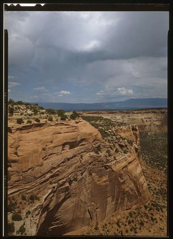
Often described as one of America’s most spectacular drives, Rim Rock Canyon takes in rugged red canyons, clear blue skies and breathtaking views. The road is a tribute to the skill, audacity and determination of the New Deal.
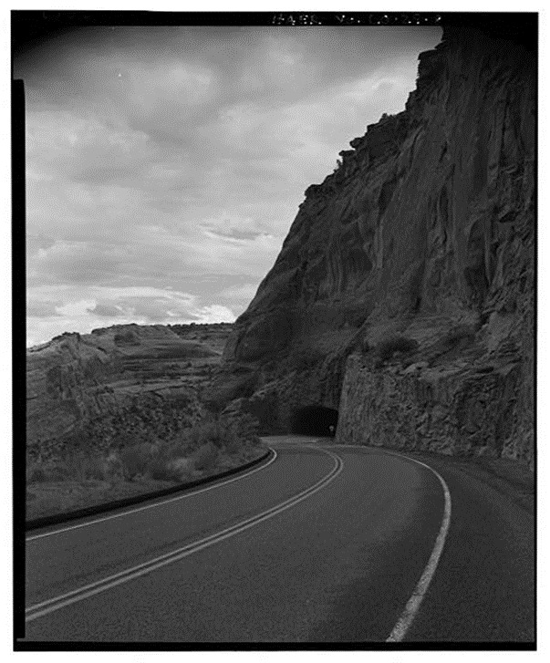
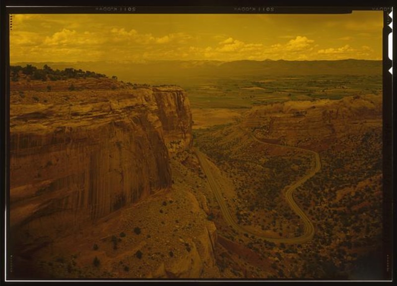
Rim Rock Drive is commonly regarded as one of the most beautiful roads in America. Three different New Deal agencies began construction of Rim Rock Drive: the Civilian Conservation Corps (CCC), Public Works Administration (PWA), and the Works Progress Administration (WPA). Work began on the road in 1932, but due to the extreme difficulty of the project, combined with a halt during World War Two, it took nineteen years to complete. The road stretches twenty-three miles along steep sunset-colored rocks connecting each end of Colorado National Monument. Since its completion in 1951, it has become an increasingly popular route.
Rim Rock Drive, climbing up steep canyons and tunnelling through the rock on three occasions, is the product of tireless work by the men of the CCC. The boys used dynamite to carve the tunnels, though in 1932, an avalanche caused by a dynamite explosion resulted in the death of nine construction workers. The deadly blast shows the inherent danger involved in some of the New Deal projects and the tenacity of the men who worked on them.
Today, Rim Rock Drive is regularly referred to as a must-see attraction on any American road trip. The hard work of the men involved in the project has left a legacy in the breath-taking road clinging to the twists and turns of Colorado’s scenic canyons and rugged mesas. The National Park Service describes the road as “inseparable from the monument,” demonstrating its status as an integral part of Colorado National Monument.
Many visitors today do not simply use Rim Rock Drive as a means of getting from one point to another, but choose to use the road in order to take in its spectacular views either by driving, walking, or biking along the route. Fourteen hiking trails, varying from short and flat to long and arduous, criss-cross the Colorado National Monument, making the area available to everyone.
Cycling Rim Rock drive has also become increasingly popular and there are plenty of options for cyclists of varying ability. Some choose to cycle the entirety of Rim Rock Drive and its climb of 2,300 vertical feet while others interested in off-road mountain biking take off for adjoining areas outside the park.
Images