Hole-in-the-Rock
Mormon pioneers settled Bluff, Utah, from 1879-1880. To reach their destination they chose a ‘short cut’ through Hole-in-the-Rock. Traveling through the passage proved much more difficult and time-consuming than anticipated.
Mormon settlers of Bluff, Utah, crossed the high desert of the Colorado Plateau and the Colorado River in 1879 on what is now known as the Hole-In-the-Rock trail. Brigham Young had called a group of southern Utah Mormons to settle southeastern Utah because few Mormon families lived east of the Colorado River. The Mormons organized quickly and decided on a route from Escalante, Utah, to a remote section of southeastern Utah. Desert terrain, canyon country, and the Colorado River all made the journey difficult..
After a relatively easy journey south of Escalante towards the Colorado River, they ran into trouble. The canyon country surrounding the Colorado River had sheer cliffs that were difficult to descend. They sent out scouts and chose a ‘short cut’ through an actual hole, they dubbed Hole-in-the-Rock. At the top of a canyon that descended to the Colorado River, there was a relatively large navigable passageway. The trail was marked by a large hole that was wide and tall enough for a few men, but not wide enough for a wagon to pull through. They sent a group back to obtain dynamite and other equipment. With great effort they blasted away the edges of the hole. The gap opened wide enough for the wagons to travel through.
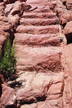
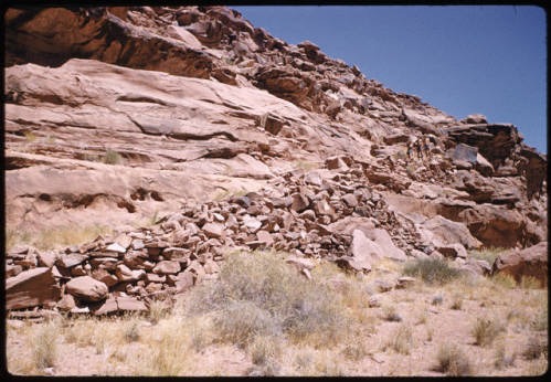
However, the descent down from the top of the cliff was difficult. The hole opened to a sheer cliff far from the river below. To descend to the canyon floor, they built a ‘floating’ road called a dugway. They bored holes into the cliff to drive metal spikes into the wall, then placed strong tree branches over the spikes and piled up rocks underneath to finish the road. Eventually they made it far enough down the side of the cliff that a dugway was no longer needed, but the terrain was still too difficult for the animals to safely walk over. They carved stairs into the solid rock to make it easier for their horses and cattle to maneuver. The rock stairway was the last part of the trail that led to the water’s edge.
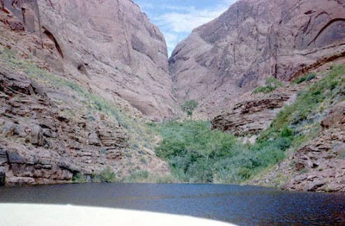
Once the party made it to the bottom of the canyon, they had to cross the Colorado River. Using a ferry that could fit two wagons at a time, they managed to get everyone across. Their journey was not over, but the most difficult phase was done. They proceeded through more canyon country and settled Bluff, Utah.
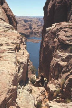
Today, some of the staircase is under Lake Powell, but most of the dugway along the cliff is still visible. One can hike down the trail from the top of the canyon through the Hole-in-the-Rock. The trail is also accessible below by boat from Lake Powell.
Images