Devil's Slide
Not far from the border between Utah and Wyoming is a compelling natural landmark: Devil's Slide. This landmark was so famous, a company used Devil's Slide as its logo.
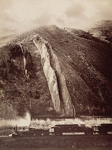
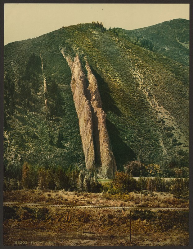
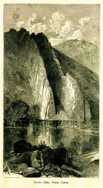
Devil’s Slide rock formation is nestled on the side of the steep Wasatch mountain range, hovering over Interstate 84. It has a height of 40 feet, and the length of the formation runs vertically hundreds of feet down a mountain. There is also an in-between space, the slide, which is about 25 feet in open space between the two vertical limestone rock slides.
It is presumed that the name of the formation was given by a railroad worker named James John Walker, whose family was one of the first to live in Croydon. According to the family history of Walker, James John was working on railway tracks in the region, likely in 1868, when some of his colleagues asked him to give a name to the strange rocky chute–his answer was Devil’s Slide.
This region is rich in limestone resources, and, in 1904, the Union Portland Cement Company was founded by several prominent Utah citizens: Reed Smoot, M.S. Browning, Joseph Scowcroft, and James Pingree. A company town soon sprang-up a couple hundred yards downstream from the plant site. The town was named Devil’s Slide after the nearby rock formation. The original plant supplied materials to most of Utah’s construction industry. After World War II, a second plant on the site replaced the original facility.
At its height, the population of Devil’s Slide exceeded 250 people. As was typical with mining towns at the time, many of the workers were foreign born. Most of them cam from Italy, Austria, Greece, and Japan. Many of the these migrant workers lived in the local hotel, the largest structure in the town. This two-story building contained twenty bedrooms on the second level with each room accommodating two men to each room. Other notable buildings located in the town were the combination drug store/post office, railroad depot, mercantile, two schoolhouses, and a company clubhouse. The company laid cement sidewalks, built a baseball diamond, and planted one hundred trees throughout the village.
By the mid-1980s, only a handful of families remained. By the end of the decade, the company decided to close the village altogether. All the families had moved on with the exception of the railroad section foreman who lived in a house owned by the railroad. The railroad demolished this house not long after the town was emptied.
Images
https://commons.wikimedia.org/wiki/File:The_Devil%27s_Slide-LCCN2008678212.jpg
https://catalog.hathitrust.org/Record/002986744