Blackfeet Removal from Glacier National Park
Before the arrival of white settlers, Blackfeet territory included western Montana and southern parts of Canada. Blackfeet land claims were challenged as American settlers moved west and railroads expanded. As a result of starvation and government neglect in the late nineteenth century, they were forced to sell 800,000 acres of their reservation, land that would eventually make up the eastern portion of Glacier National Park.
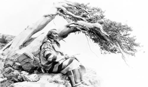
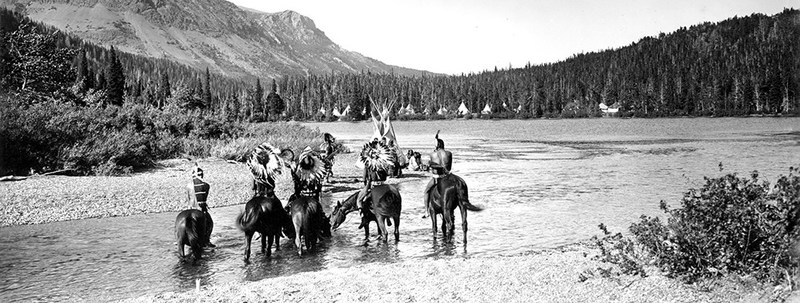
The Blackfeet Confederacy is made up of four bands: Piegan Blackfeet, Siksika, Piikani, and Kainai. Similar to other Great Plains tribes, they followed a yearly cycle which included hunting and gathering in the Rocky Mountains, what they called the “backbone of the world.”
In 1855, the Blackfeet signed the Lame Bull Treaty with the U.S. government which guaranteed their claims to land in Northern Montana and provided them with an Indian agent and annuities.
In 1870, following the revenge murder of a white rancher and his son, General Philip Sheridan sent Major Eugene Baker to find the leader of the attack. A camp of Piegans led by Heavy Runner was misidentified as the hostile band, and despite efforts by Heavy Runner and an army interpreter to prove their innocence, Baker ordered an attack. The number of deaths is disputed, but between 173 and 217 Piegan Blackfeet were killed. 140 were captured and became refugees at Fort Benton. The event became known as the Baker Massacre and marked the end of active Blackfeet hostility.
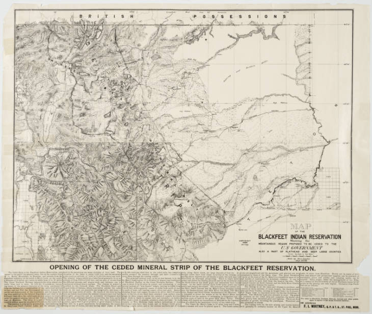
In the late 1870s, the Blackfeet faced starvation on their reservation. The government had eradicated the buffalo and rations were limited. The Blackfeet left the reservation to hunt, but were forced back by an army escort in 1880. Following their return, they became fully dependent on the government. Hundreds of Blackfeet starved to death on the reservation during the winter of 1883-1884. In need of money for food and supplies, they sold 800,000 acres of the western part of their reservation to the government in 1895. During the negotiations, Piikani Chief White Calf complained about the loss of sacred mountain land, calling it his people’s “last refuge,” and Little Dog reminded commissioners that they “did not ask the government to come and buy their land.”
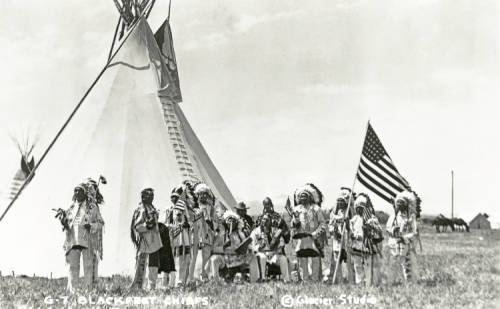
In 1897, the ceded land was made a forest reserve, and Glacier National Park was created in 1910. The Blackfeet were central to many of the park’s advertising campaigns, especially those produced by the Great Northern Railroad. The Blackfeet accounted for over a third of Great Northern’s advertising images, making up more of the campaign than images of scenery. They were employed in the park and officials kept many Blackfeet place names. Unlike other National Parks, Glacier became synonymous with Indian presence.
With the park’s creation however, courts ruled that Blackfeet rights to access the mountains in the park were obsolete. In 1932, a US District Court ruled conclusively that they had no rights to hunt in the park. Claims resurfaced in 1973, when a judge ruled in favor of the Blackfeet, protecting their right to enter the park without paying the entrance fee. Even with limited access, the Blackfeet still feel the responsibility of their peoples’ “Covenant with the Creator.” One Kootenai woman said recently, “we are put here for a purpose and that is to guard our Columbia River Basin...that is why we are still here and that is why the [Spirits] are never going to let us go.”
Images