Moab’s Uranium Mill Tailings Pile
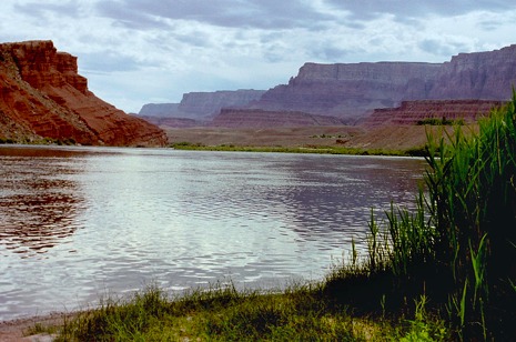
Moab, known in the 1950s as the “Uranium Capital of the World,” is now better known as the home of Arches and Canyonlands National Parks. However, hikers, campers, rock climbers, and mountain bikers who visit Moab ought to be aware of the town’s connections to uranium mining. Every day, 136 containers of radioactive waste are transported alongside the highway that visitors take to get to either park. Furthermore, those who visit Lake Powell or Mead, the Grand Canyon, or any section of the Colorado River south of Moab ought to be aware of the 10.8 million tonnes of radioactive tailings that are being transported to a safer site but currently sit a few hundred feet away from the river.
Outdoor enthusiasts are drawn to Moab because of its location along the Colorado River and its proximity to both Arches and Canyonlands National Park. The federal government has taken an active role in the conservation of land and wildlife in the area, but it has also partnered with entrepreneurs in the private sector who mined for uranium ore, a radioactive mineral that exists in abundance in parts of the southwest. Moab is a town where opposites meet—clean soil meets radioactive dust. The air, while fresh, could be dangerous to visitors who camp or kayak downwind from its massive uranium mill tailings pile.
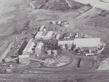
During the Cold War, the U.S. military encouraged prospectors to search for uranium ore to create stockpiles of atomic and hydrogen bombs to defend against the Soviets. In 1952, thirty-two-year-old prospector Charles Steen discovered the country’s largest uranium deposit in Moab. Ore was extracted at the Mi Vida Mine and processed at the nearby Uranium Reduction Company. After it was processed, the hazardous waste was deposited in an unlined pond adjacent to the Colorado River. In 1962, Steen sold the processing company, which continued as the Atlas Uranium Mill. In 1984, the mill was permanently closed and the pond was covered. However, given the site’s proximity to the Colorado, pollutants from the waste began to leech into the river—one of America’s most important rivers, which is a source of drinking water for more than 40 million people and flows through Las Vegas’s Lake Mead.
In 2001, management of the site was transferred to the U.S. Department of Energy. In 2005, it announced that 10.8 million tonnes of the radioactive tailings would be moved from along the Colorado River, mostly by rail, and buried in a lined hole in Crescent Junction, twenty-eight miles north of Moab. The first relocation occurred in 2008 and might take more than twenty years to complete. Although a radiological survey has verified that the containers have no radioactive material on the outside, Dr. Gene Cole, a retired BYU professor and an environmental health specialist, has argued that it is impossible to completely prevent harmful tailings from spreading along the route, which passes alongside and under U.S. Route 191. Inconveniently, this state highway is the one that most drivers take when visiting Arches and Canyonlands National Parks, as well as iconic Monument Valley. In July 2014, the 7 millionth ton of tailing was placed in the Crescent Junction holding cell, where it should be secured. Nevertheless, who really knows how much radioactive dust blows off along the way?
Images